
The Estuary is a fantastic place to explore by foot, cycle, wheelchair or buggy, with miles of safe walking and cycling trails around the entire estuary which offer some spectacular views.
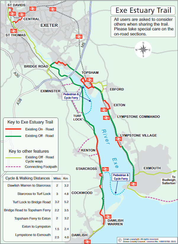
A fantastic scenic route around the entire Exe Estuary for a range of users. Always keep dogs under effective control on a short lead and consider those who are wary or nervous around dogs. Remember to ‘Share this Space‘ by being considerate of other users of the trail.
This leaflet from the Exe Estuary Management Partnership is a guide to the footpaths, cycle ways and public transport options available around the Exe Estuary. The centre of the leaflet provides a detailed map of the estuary including the various ferry routes and docks, train routes and stations, bus routes and stops, key viewing points, parking, and toilet and refreshment facilities.
The estuary is very well served for those who love the water and there are a number of slipways all along the foreshore, served by main roads.